Detecting Land Changes Over Time EDITED
Land-use and land-cover classification is measuring changes, or disturbances, to the land surface caused by human activity or natural events. These changes include those caused by land development, resource extraction, fires, and insects. Alberta’s decision-makers use information about the types and extents of land disturbances on the landscape for regulatory planning, sustainable energy development, land-use planning, and cumulative effects management. We measure the land changes using annual Landsat and Sentinel-2 satellite imagery. The process we use is transparent, repeatable, location specific, and provides evidence-based information to decision-makers.
More About Land-Use and Land-Cover Classification
The magnitude of land disturbance determines the process necessary to restore the vegetation ecosystem in the affected area. We study large-area land-cover variations and long-term patterns associated with disturbances, such as deforestation, disasters, and urban expansion, using both Sentinel-2 and archived Landsat imagery. Sustainable land-change management requires quantifying natural and anthropogenic (i.e., manmade) disturbances as each disturbance affects the ecology to a differing degree, which affects whether vegetation regeneration occurs, and at what rate. Land-use/land-cover monitoring helps determine the baseline conditions and the disturbances’ affects on the biophysical environment at a site (e.g., altering vegetation types and revegetation rates, altering local hydrology, releasing pollutants), information critical for a cumulative environmental impact assessment.
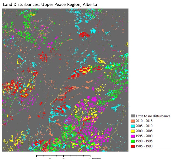
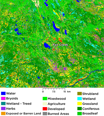
To quantify land-use/land-cover changes in the Upper Peace Region, one of the major oil and gas exploration sites in our province, we analyzed Landsat satellite images at five-year intervals, from 1985 to 2015. These images showed harvesting (land disturbed by logging activities) caused more than 60% forest loss and energy footprints (land disturbed by oil and gas activities) caused less than 20% forest loss. We observed signs of forest regeneration in at least 55% of the harvested areas and 16% of the energy footprints.
Learn More
Time-Series Land-use/Land-cover Classifications of the Upper Peace Region of Alberta
The Athabasca Oil Sands surface mineable area in northeastern Alberta is the site of oil and gas activities. To assess the land-use/land-cover changes over this 13 267 square kilometre area, we analyzed Landsat satellite imagery from five-year intervals between 1985 and 2016 and Sentinel-2 satellite imagery from 2017. This analysis revealed mining activities caused the loss of
- 276.08 square kilometres of wetland and
- 673.25 square kilometres of forest.
Wildfires in the area caused the loss of
- 180.39 square kilometres of treed wetland and
- 1172.02 square kilometres of forest.
Learn More
Time-Series Land-Use/Land-Cover Classifications, Athabasca Oil Sands Surface Mineable Area