Earth Observation using Remote Sensing Techniques
We use remote sensing techniques for Earth observation (EO) – collecting information about Earth’s physical, chemical, and biological systems without coming into physical contact with the object we are observing. Remote sensing and Earth observation (EO) techniques evolved over the years from examining aerial photographs in the 1950s to evaluating satellite imagery in near–real-time today. Our experts use satellite imagery for detecting changes to the land surface over time, assessing mineral resource potential, and evaluating air quality. Our work in detecting land changes over time helps us monitor reclamation efforts and spill contaminations, reducing some risks Alberta faces when managing natural resources and protecting the environment.
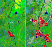
Detecting Land Changes Over Time
Discover how we detect the progression of land use and vegetation changes.
More Details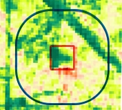
Oil, Gas, and Mine Site Reclamation
We monitor vegetation recovery at sites impacted by energy industry activities.
More Details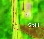
Aiding Spill Incident Response
Determining when a leak or spill incident occurred and its impact on the area.
More Details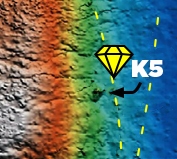
Exploring for Mineral Occurrences
Testing new ways to map and explore for mineral deposits..
More Details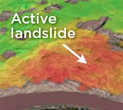
Detecting Slow Ground Movements
Detecting and measuring slow ground movements using InSAR.
More Details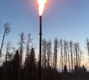
Air Quality and Greenhouse Gases
Learn how we monitor pollutant and greenhouse gas levels.
More Details