Determining Water Quality
The quality of groundwater tells us how it can be used. It might be suitable as a source of drinking water, for crop irrigation, industrial use, or maybe as a source of important elements like lithium. Groundwater quality mapping helps to understand how well-connected aquifers are to surface water bodies, how active groundwater flow systems are, and how quality could be changing over time. These are some of the reasons for why we map groundwater quality from near the land surface to the deepest portions of the Alberta Basin.

More About Groundwater Quality
Mapping groundwater quality from the land surface to the Precambrian basement is a key component of our Groundwater Geoscience Program. We have a long history of groundwater quality mapping with some of the earliest reports released in the late 1950s. The primary purpose for mapping groundwater quality then was economic development. Rural, urban, and industrial development in the province of Alberta required knowledge of near surface groundwater resources to grow as a province. Since these earliest days of the Groundwater Geoscience Program however, our focus has shifted to understanding groundwater quality in saline and non-saline aquifers.
Read about our history of groundwater mapping.
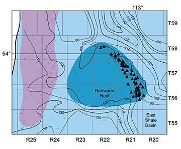
Our work on groundwater quality in the deepest portions of the Alberta Basin was instrumental in understanding regional groundwater flow and in characterizing and categorizing subsurface pore space for uses such as carbon capture and storage, acid-gas injection, and fluid waste storage. Our ongoing work in the deeper portions of the Basin continues to examine these pore space uses and, in addition, examines the potential for critical mineral extraction from produced water.
Learn more about:
- CO2 disposal, saline aquifers in west-central Alberta and gas migration
- saline aquifers in west-central Alberta
- gas migration
- lithium in brines
- commingled well abandonment
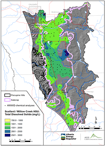
Our groundwater quality mapping in intermediate and shallower intervals of the subsurface has built on our understanding of the transition between saline groundwater (defined in Alberta as groundwater with a total dissolved solids concentration of >= 4 000 mg/L) and non-saline groundwater. This transition marks the depth of the base of groundwater protection, an important tool in regulating well drilling, oil and gas production, well abandonment, and groundwater licensing. Higher total dissolved solid (TDS) non-saline groundwater can be used for industrial and agricultural purposes without treatment and can be made suitable for drinking with minimal treatment. Lower TDS saline groundwater can be suitable for many industrial purposes with or without treatment as well. Mapping these types of groundwater identifies important water resources, providing a better inventory of regional groundwater resource studies.
Learn more about:
Base of Groundwater Protection (BGWP)
Alberta’s total water supply:
- Calgary-Lethbridge Corridor
- Edmonton-Calgary Corridor
- South Athabasca Oil Sands Area
- Cold Lake Oil Sands Area
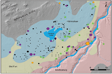
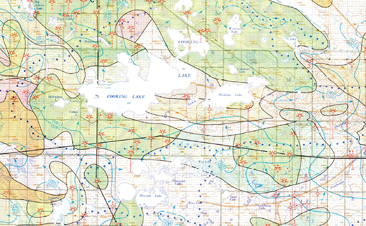
Our work on near-surface aquifers is shedding light on how groundwater and surface water interact, the complicated nature of how aquifers are recharged, and the interconnectivity of aquifers. The implications that extracting water from a surface water body has on shallow groundwater, and vice versa, are important to consider as we seek to understand the broader implications of water use. We believe that uncertainty around long-term patterns of precipitation along with changing patterns of surface water and groundwater-use make understanding these shallow interconnections more important.
Learn more: