Map 632
| Author(s) | Date | 2023-01-12 |
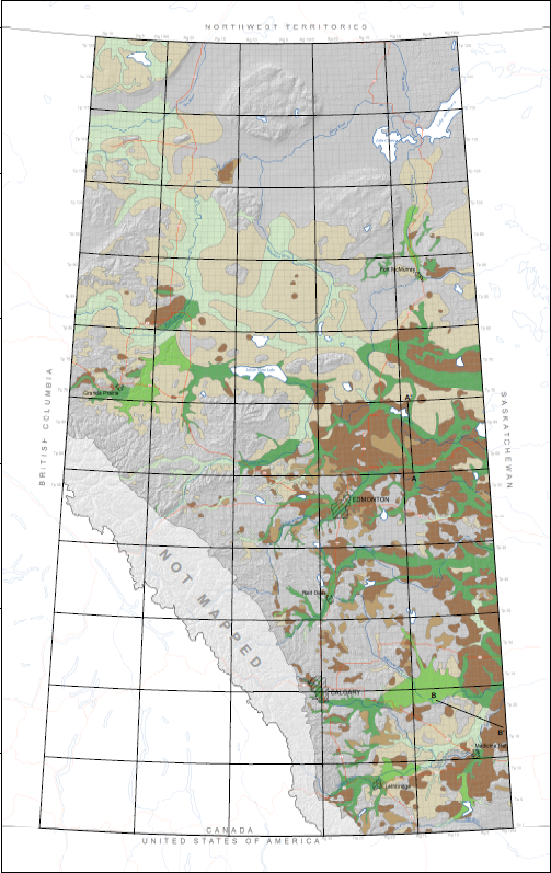
This map shows the distribution of sediments above bedrock that are either known or are inferred to contain aquifers. Sediments are defined as being aquifer hosting if they contain sufficient permeable material to supply groundwater to a well. Evidence of permeable material is based on the geologically determined occurrence of sand and gravel deposits and the distribution of water supply wells completed above bedrock (indicative of groundwater production from sediments above bedrock). Aquifer-hosting sediments are further classified according to their physiographic position on the bedrock surface: those within buried bedrock valleys, and those on the surrounding bedrock plains and uplands. The bedrock plains and uplands physiographic positions are grouped together in this map.
Areas containing thick sediments, such as buried valleys, may host multiple aquifers which typically vary in thickness and lateral extent. However, delineating individual aquifers or the degree of vertical and lateral hydraulic connectivity of aquifer systems is beyond the purpose of this map.
NTS Keywords
Theme Keywords
Hartman, G.M.D., Pawley, S.M., Liggett, J.E., Atkinson, N. and Utting, D.J. (2023): Distribution of aquifer-hosting sediments above bedrock in Alberta; Alberta Energy Regulator / Alberta Geological Survey, AER/AGS Map 632, scale 1:3 000 000.