MAP 627
| Author(s) | Date | 2022-10-19 |
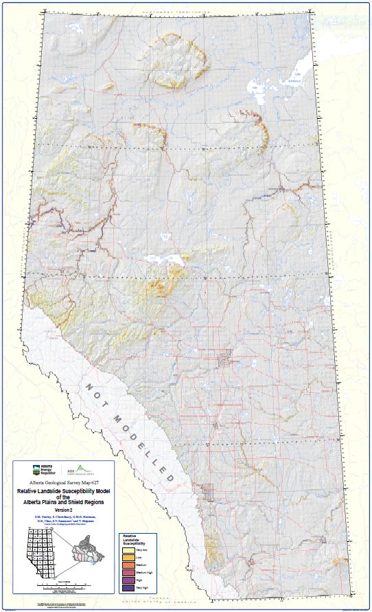
This map represents a predictive statistical model of landslide susceptibility of the Alberta Plains and shield regions at 1:1 000 000 scale. The model predicts the degree to which terrain can be affected by landslides based on a statistical procedure that establishes the relationship between the spatial distribution of past landslides, and predisposing geological, topographic, and climatic factors. This map updates and refines the landslide susceptibility portrayed in AGS Map 605 by: (a) using more detailed topographic information derived from light detection and ranging (LiDAR) DEM data; and (b) incorporating new landslide locations that were compiled from multiple data sources including high-resolution multi-temporal satellite imagery and ground deformation monitoring from satellite interferometric synthetic aperture radar (InSAR). Version 2 also provides a more accurate prediction of where future landslides and landslide reactivations are likely to occur because the susceptibility rating is based on the spatial distribution of historically active landslides, rather than a mixture of active and relict landslides.
The model results portray the spatial distribution of landslide susceptibility as a relative ranking from low to high. It is intended to be used for educational purposes and regional-scale planning initiatives. Importantly, the predictions show 'where' future landslides are more likely to occur, but do not predict 'when' they are likely to occur. It also does not evaluate the magnitude or impact of any potential landslide activity. Consequently, the model results should not be interpreted for the purpose of site-specific landslide activity assessment or hazard appraisal.
NTS Keywords
Theme Keywords
Pawley, S. M., Chowdhury, S., Hartman, G.M.D., Chao, D.K., Samsonov, S.V. and Shipman, T. (2022): Relative landslide susceptibility model of the Alberta Plains and shield regions, version 2; Alberta Energy Regulator / Alberta Geological Survey, AER/AGS Map 627, scale 1:1 000 000.